 Doug Mink photo |
Top: Home Page
Up: Table of Contents
Previous:
Next:
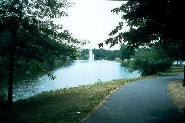
The Esplanade in Boston is parkland, under the the control of the Metropolitan District Commission (MDC), the Boston area's regional park district. The Esplanade is bounded on one side by the Charles River and on the other by Storrow Drive, an express highway. The Esplanade offers a scenic view of the Charles River lower basin and the Cambridge shoreline on the far side. Landscaping features include pools with fountains. General motor traffic is excluded from the Esplanade, though a few motor vehicles enter for service or maintenance purposes. The paths along the Esplanade were designated as part of the Paul Dudley White bicycle path system in the 1960s. They provide access for bicyclists, pedestrians and inline skaters to the parkland, including a playground, boathouses and the Hatch Shell, with its summer program of concerts. The paths also serve as a transportation route. Access to the paths is via several overpasses across Storrow Drive, and at street level at Leverett Circle. |
Pool and fountain on the Esplanade
Doug Mink photo |
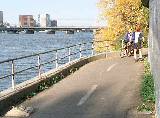
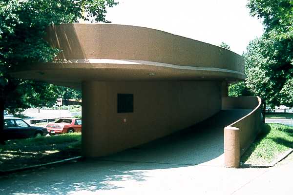
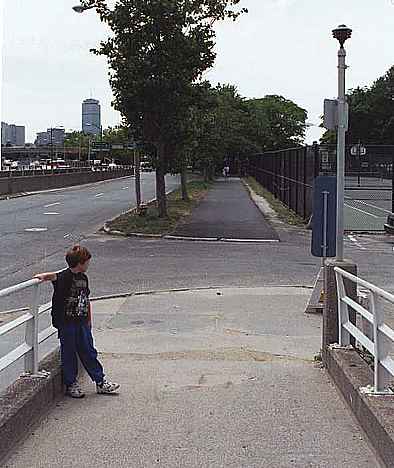
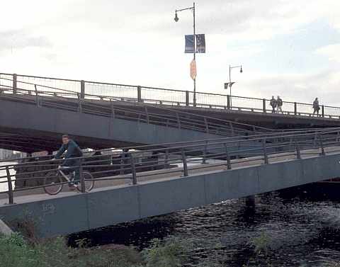
The overpasses that connect the paths to the city streets are designed to meet handicap access standards, with gentle slopes that make them rideable on bicycles, though the overpasses have sharp switchbacks, are relatively narrow and have somewhat lower railings than are standard for bicycle facilities. The overpass at Leverett Circle, shown in the photo below, is typical. |
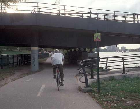
Two of the overpasses are unlike the others. The design of the Fiedler Footbridge, near the Hatch Shell, makes an architectural statement, but reflects a serious disregard of safety issues. The concrete walls at its switchbacks pose a serious risk of collision and of physical attack. And another footbridge just east of the Boston University Bridge has only stairs, no ramps. It is discussed further at the end of this page. |
The Fiedler Footbridge
 Doug Mink photo |
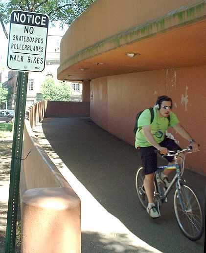
As of 2003, signs like the one in the photo below appeared at the ends of the overpasses. These signs are frequently disregarded: inline skaters are very unlikely to remove their skates and walk across theoverpass in their stocking feet. Another version of the sign reads "rollerblading, skateboarding and bicycling prohibited." That at least is worded so as to make it legal to carry inline skates and skateboards. When placed at the end of the bridge opposite the park, it suggests that bicycling is prohibited everywhere in the park. |
| As of April, 2006, this sign has disappeared (though other examples of the same sign remain), but what is that on the back side of the signpost?? |
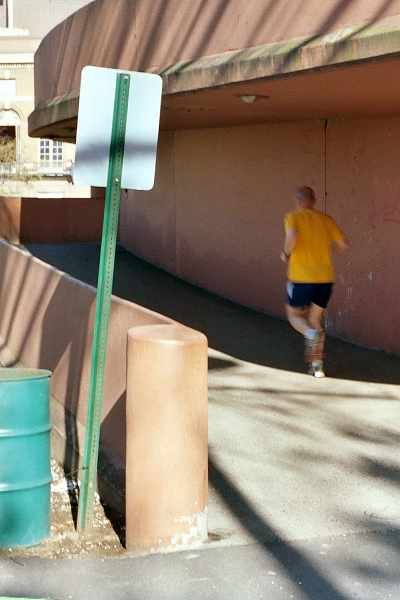
| Park closed, dusk to dawn! An interesting concept indeed for the bicycle paths, which are a transportation facility. And how will it be possible to hold the annual Fourth of July concert and fireworks display, among the many other evening events at the Hatch Shell? Apparently, the Department of Conservation and Recreation, which absorbed the Metropolitan District Commission, has blindly applied the same policies to this urban park as to state parks in rural areas. |
Placing the sign where people have already come all the way over the bridge before seeing it also makes rather little sense. This kind of does not increase respect for signs in general, or for the Department of Conservation and Recreation.. I speculate that the DCR doesn't have jurisdiction of the city sidewalk where the footbridge comes down at the other end, and the sign placement is governed by where crews are allowed to work. Such jurisdictional issues are responsible in large part for signage problems in Massachusetts. Now let's take a tour of the bike path starting at Leverett Circle. Looking west down the Leverett Circle ramp, the path first crosses a driveway to a police parking lot, and then parallels a fence. The ramp's slope poses the hazard of collision between an out-of-control bicyclist or inline skater and a motor vehicle in the driveway, which has no crosswalk markers that might warn motorists. Fortunately, the driveway is used lightly, by State Police personnel, and it is the only driveway in the Esplanade that gets regular daily use. (Note: this location has changed as of 2006, and some of this paragraphs may no longer apply, but I haven't been back yet to examine the changes). The path segment adjacent to the roadway places bicyclists in the bright side of motorists' headlamp beams when riding toward the camera position. |
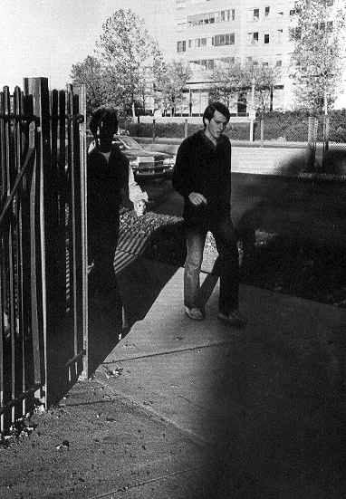
At the other end of the fence shown above is one of the many sightline problems along the path. This problem has existed since long before I took this black and white photo in 1978 and remains unchanged in the year 2001. Chain link fences and picket fences are deceptive: people tend to think of them as transparent, but at low angles, they are not. An appropriate improvement here would be to install an open-structured barrier so that path users coming from the direction of the camera would have to make a wide turn, increasing sight distance. |
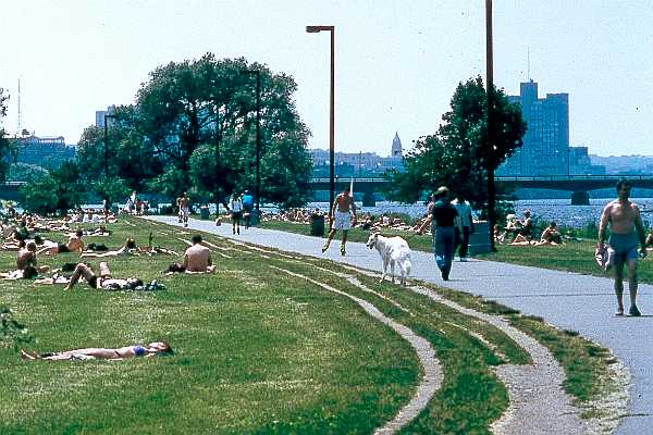
The Esplanade paths are heavily used, especially in the warmer months. Over the years, the MDC has taken some steps to reduce the resulting conflicts on the paths. Where path segments parallel one another, bicyclists have been prohibited from riding on one of them, generally the one closer to the river. This sometimes means riding close to the highway and being denied a good view; but all in all, conflicts are reduced. Also, a dashed center stripe has been painted along the parts of the path designated for bicycle use. But many parts of the paths were not originally intended as bicycle paths, and it shows. There has been some improvement over the years, yet compromise with design standards, or simple lack of regard for them, has occurred in recent construction. The photo below shows a section of path near the river from which bicyclists are prohibited. |
Esplanade path during a time of heavy use. Signs indicate
that bicyclists must not ride on this path section, and instead
must use a parallel section farther from the river. There is
nonetheless one bicyclist in the photo.
 Doug Mink photo |
The next photo shows the section of path which bicyclists must use because they are prohibited from the one in the preceding photo. The fence on the right provides a welcome obstruction to glare from car headlights on Storrow Drive, but this section is noisy and not very scenic. The path is rather narrow, and for bicyclists, the high curb on the water side is a hazard rather than a safety feature. The signpost narrowing the path is another hazard. The roots of the small trees planted next to the path have already begun to heave it up in places. |
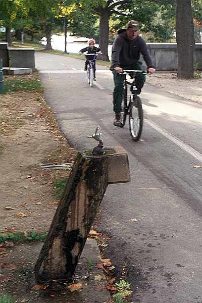
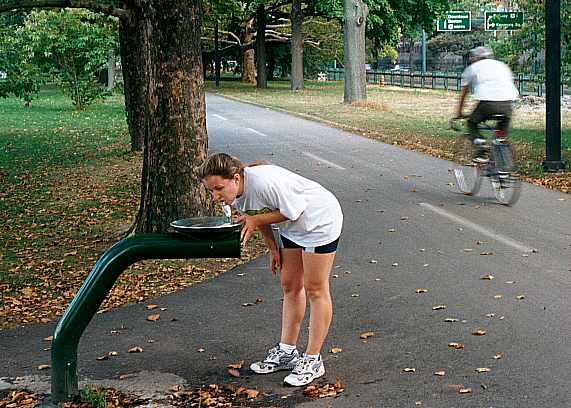
| There are two types of water fountains along the path. The several water fountains of the older type, supported on a concrete pillar, are placed directly adjacent to the path. Apparently, the intention was to make it as convenient as possible for path users to use the water fountains, as with a drive-up ATM or fast-food window. Such devices are normally placed only on single-purpose driveways, never on through routes. The location of the water fountains not only poses a hazard by itself, but also encourages people to stand in the path while taking a drink. |
Older-type water fountain placed adjacent to path.
The stone wall in the background is also too close
to the path, but it predates designation of the path
for bicycle use. The center striping is a recent
improvement.
Newer water fountain is set back from edge of path.
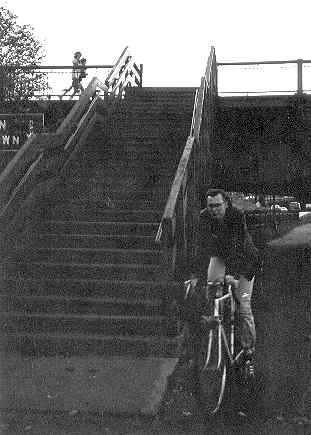
At the Harvard Bridge, which carries Massachusetts Avenue over the Charles River, there is a ramp between the path and the downstream sidewalk. This ramp has good and bad characteristics:
|
Old stairs between path and
Harvard Bridge, 1978 photo.
|
Ramp from path to downstream side of Boston end of the Harvard Bridge
| Scroll right to view the rest of this panoramic image. |  |
 Scroll left to read text. |
 |
| The path snakes under the Charlesgate flyover ramps. Here, there is not room to separate bicycle and pedestrian traffic. At one time, there were light poles (or perhaps poles for directional signs for the overhead ramps) in the path. The poles have now been removed but, as shown in the photo below, a concrete lamp base (lower left) remained as of 2001. The lamp base increased the risk of head-on crashes, which is already serious due to the blind corner. It was removed in 2002. That the centerline here is dashed rather than solid reflects an all-too-typical failure to apply basic principles of highway engineering. The railing here is adequately high to restrain bicyclists from going into the river, though it lacks a handlebar rub strip. |
Blind corner and lamp post base in path at flyover ramp
The lamp post base was removed in 2002.
|
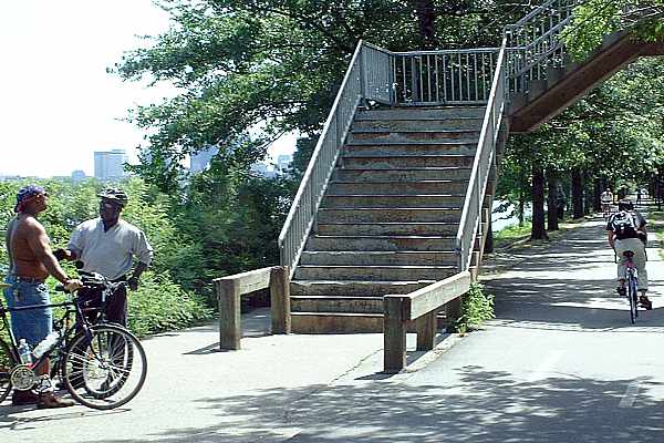
| The last overpass of Storrow Drive before the Boston University Bridge has only stairs, not ramps. The wooden barrier prevents people from stepping directly from where they are hidden by the stairs into the path of bicyclists. It is clearly a recent addition, and probably in response to recorded collisions. There was no such barrier at the old stairs to the Harvard Bridge. |
| All in all, the path has improved over the years, yet many problems remain. Some are inherent in the traffic mix and others result from existing structures which would be very difficult and expensive to change. But other problems have resulted from a continuing failure to apply good design standards or consistent and sensible policies. |