Top: Home Page
Up: Alewife Station area
Previous: East of station


ALEWIFE BROOK PARKWAY,
CAMBRIDGE

Locations O, P, Q in aerial photo

Alewife Brook Parkway runs from Concord Avenue in Cambridge north past Alewife Station. It passes shopping centers on each side and then rises on an overpass over commuter rail tracks before it reaches the station. This part of Alewife Brook Parkway is part of Massachusetts Route 2, a major commuting Route between Boston's western suburbs and the urban core.

Until the mid-1990s, the Parkway had narrow travel lanes and narrow sidewalks. As it was the only route connecting Alewife Station with the shopping and business areas on the south side of the railroad tracks, it posed a major impediment to bicyclists.

The overpass was in deteriorating condition and had to be replaced. Along with the construction of a new overpass, the Parkway was widened, and wider sidewalks were constructed.

One odd feature of this construction is that the east sidewalk is 10 feet wide, while the west sidewalk is only 6 feet wide. The east sidewalk may have been intended to serve as a bicycle sidepath, though it has never been designated as one. It connects with the very troubling designated bicycle sidepath  along Concord. Avenue; this connection suggests that an overall plan to provide bicycle access on sidewalk-type facilities underlies the construction of the wide east sidewalk.

The shoulders of the Parkway are generally wide enough for bicycle/motor vehicle lane sharing, though right lane/shoulder width is not maintained consistently.

This sidewalk is crossed by only one entryway, at the entrance to the Fresh Pond Mall. This entryway is signalized, but it has serious design problems, as shown in the photo below. The 10-foot wide sidewalk and 10 foot wide crosswalk are connected by narrow curb cuts. The narrow channel between the entrance and exit roadways is not even wide enough for two wheelchairs to pass one another. The row of trees between the roadway and the sidepath will increasingly block sight lines as their trunks grow.

The Metropolitan District Commission, the Massachusetts Highway Department and the city of Cambridge all reviewed the plans for this project.


Shopping center entryway on east side of parkway
(Location Q in aerial photo)

9905N11R07Shopping center entrance.jpg (43765 bytes)


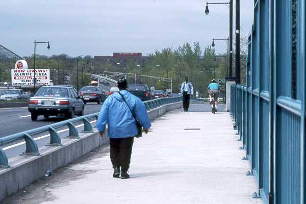
The 10 foot wide sidewalk on the east side of the bridge is shown in the photo below. The bicyclist in the background is approaching a blind corner.

10-foot-wide east sidewalk of overpass
(Location P in aerial photo)

9905N11R09Bridge.jpg (28463 bytes)


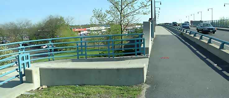
The blind corner is shown from the opposite end in the photo below (scroll right if necessary to see  the rest of the panoramic image).

DSCF0099sm.jpg (29109 bytes)


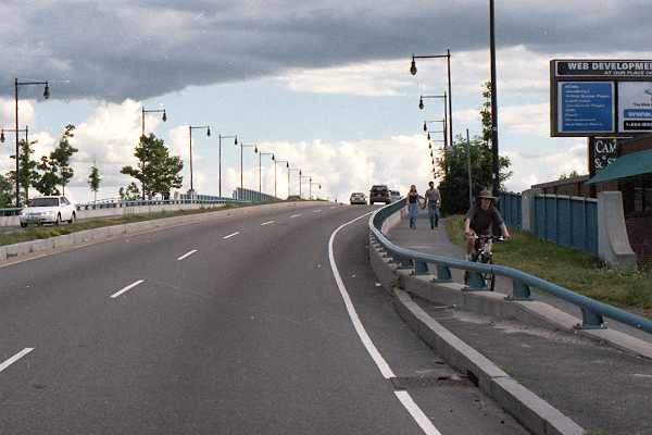
Bicyclists proceeding south across the bridge from Alewife Station have the choice of entering the roadway where there is no shoulder, or riding on the narrower, 6-foot sidewalk. Using this sidewalk allows bicyclists proceeding north to the station from west of the Parkway to avoid crossing the Parkway twice. For this reason, there is two-way bicycle and pedestrian traffic on this sidewalk. Also note that the shoulder has been tapered down in the foreground of the photo, where motorists enter from Rindge Avenue. The storm grate in the foreground is bicycle-friendly.


Looking south across the bridge along the path,
just south of Rindge Avenue, 2001
(Location O in aerial photo).

Alewife pkwy bridge.jpg (24366 bytes)


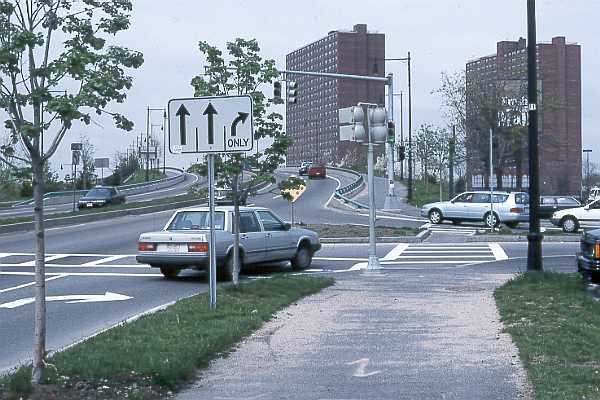
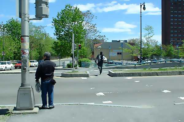
The picture below shows the crosswalk just south of Rindge Avenue, looking east. The bridge is to the right. Note the narrow cut-through in the  median, like those elsewhere in the project. Bicyclists who use the east sidewalk on the bridge use this crosswalk to reach Alewife Station.


DSCF0107rindge.jpg (33804 bytes)


Top: Home Page
Up: Alewife Station area
Previous: East of station

Contents © 2002, John S. Allen ,
May be reproduced, with attribution.