Top: Home Page
Up: Table of Contents
Previous:
Next:
Steve Faust, a New York cyclist and urban planner, rode the Province Lands trails in
the early 1970s, when they were new. His recollection:
The trails have been repaved at least once since, and probably widened and straightened some. But did that solve the problems? One governing assumption behind the creation of the trails was that the National Seashore should provide a recreational experience for bicyclists. Well, good enough. Another assumption was that bicyclists must be separated from motor traffic in order to be safe. That is the case for young children riding bicycles, but these trails are unsuitable for the same bicycling population they attract. These trails were designed in the 1960s, when no standards for such trails existed, but it really shouldn't be necessary to look in a book to identify the problem. All too typically for park projects developed by a remote agency, the safety issues did not get the attention they deserve. The outer end of Cape Cod is a huge pile of sand, a terminal moraine from the most recent Ice Age. Parts of the Province Lands trails pass through woodland where the sand is stabilized by roots and forest litter. Closer to the beaches, the trails pass through sand dunes. There are steep grades, sharp curves and blown sand on the trails. Cyclists risk diversion-type falls at the step-like edges of the pavement where sand has blown away, or where it is soft so bicycle tires sink in. Environmental standards did not exist in the 1960s -- trails could probably not be constructed at all now in the sand dunes -- though on the other hand, the trails provide access to an unusual and stunning landscape. It is rare to be able to travel through such terrain on a bicycle: even off-road bicycles can't negotiate the deep, soft sand off the trails (nor should they travel off pavement in this environmentally sensitive area). But I recommend these trails only to cautious, experienced bicyclists. Another bicycling advocate, Bryce Nesbitt, has a similar impression and proffers a solution to the problems:
We will now take a photographic tour of the trails. You may follow it on the map, which is on a separate Web page. Most of the photos below were taken on September 7, 2001; exceptions indicating changes since that time will be noted. The route to Herring Cove Beach from Provincetown is on Bradford Street Extension and Province Lands Road, which are also part of Massachusetts Route 6A. The part on Bradford Street Extension has a bike lane, oddly marked with some markings facing the wrong way. A similar lane on the far side of the street is marked for pedestrians only. A wrong-side bike lane requires bicyclists to violate the traffic law. Riding opposite the flow of traffic greatly increases the risk of collisions. The bicyclists in the photo below are ignoring the wrong-way bike lane marking and riding in the lane marked for pedestrians on the other side of Province Lands Road. [Corrected as of summer 2011: there is now a conventional bike lane on each side of the road.] |
A on map:
On Province Lands Road, headed toward the beaches.
Bicyclists headed back to Provincetown ignore wrong-way bike lane.
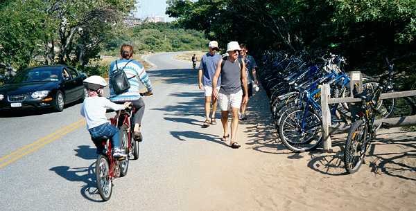
Along Province Lands Road closer to Herring Cove beach is the entrance to the notorious Provincetown nude beach. The family cyclists in the next photo are riding right on by. There is a well-used bike rack next to the road. The photo looks back toward Provincetown. Province Lands Road is narrower then Bradford Street Extension, without bike lanes or shoulders, but traffic is light. [Improved as of summer 2011: the road has been widened, and now has bike lanes.] Most motor traffic to and from Herring Cove Beach takes Massachusetts Route 6, which offers plentiful capacity thanks to some long-forgotten boondoggle. Route 6 is 4 lanes wide all the way through Provincetown to the beach parking lot at its end, although only 2 lanes wide in Truro, the next town down the Cape. |
Province Lands Road looking back toward Provincetown at beach.
| The Province Lands trail starts with a turnoff from Province Lands Road before Herring Cove Beach. The crosswalk-type junction here does not reflect the way bicyclists actually ride, but rather tends to assume that they will stay at the right side of the road, stop and walk across. A jug-handle left turn or bicycle left turn lane would be more realistic. The bollard at the entrance is an unnecessary hazard. Why would anyone mkae a sharp left turn and drive on the trail when the road leads to the same destination? |
Start of trail at Province Lands Road
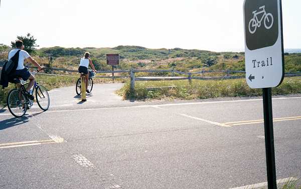
The sign below, also seen in the background of the photo above, gives some useful advice, and a long list of warnings about the trail. This sign is relatively new. To some extent, it reflects an acknowledgement of problems, and to some extent also a shifting the burden of responsibility to the users. The 10 mph speed limit is realistic for reasons of safety on many parts of the trail, though very conservative in others. Current design guidelines for paths specify 20 mph, and 30 mph for downgrades. The sign recognizes that the trail is used by pedestrians (and equestrians, though I have never seen a horse, or horse droppings, on it, and equestrians tend to avoid paved surfaces). The sign does not mention inline skaters. The term "bicycle trail" is used. It is obsolete; current terminology is "multi-use path", reflecting the reality of use of such paths. But on the other hand, much of this path is useful only for bicyclists, and only for a certain category of bicyclists, as Bryce points out. Novice and child bicyclists; wheelchair users and inline skaters do poorly here, and the distances are too long for most pedestrians. |
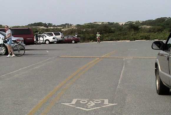
| The trail enters the Herring Cove Beach parking lot at location B on the map. A study from the late 1980s revealed the parking lots to be the location of a large number of bicycle crashes reported to police. That is not surprising considering the poorly-organized movements of motor vehicles and pedestrians in a parking lot. |
Trail enters Herring Cove Beach parking lot. B on map.
The parking lot has speed bumps, which are hazardous to bicyclists. When approaching the trail, bicyclists may ride around the end of the speed bump shown, though at some risk of having their wheels go off the edge of the pavement into the soft sand, leading to a diversion fall when attempting to return to the paved surface. |
Speed bump -- note bicycle tracks in sand.
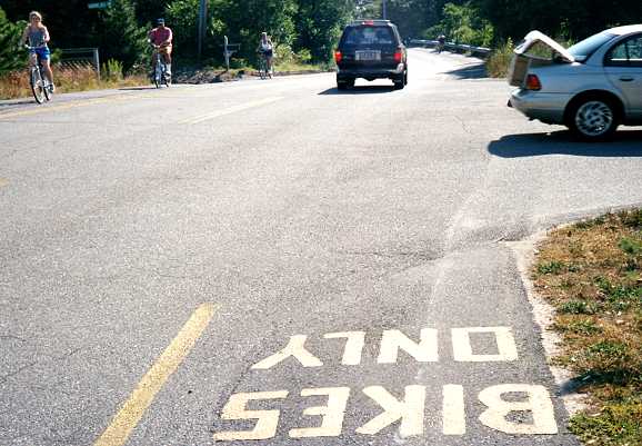
Trail entrance is at green arrow. C on map.
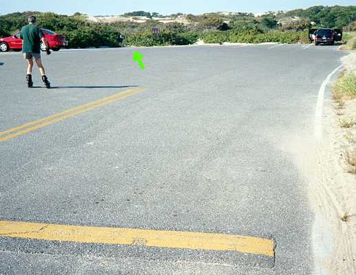
As of September, 2006, this location had been "improved" by the installation of shared-lane markings -- except that the markings for both directions are on the same side of the double yellow line. They instruct southbound bicyclists to ride opposite the direction of traffic, in violation of the law, and northbound cyclists to ride to the left of same-direction motor traffic which turns left into parking spaces. Bicyclists in both directions who are foolish or trusting enough to follow these bizarre instructions also must ride over rather than around the speed bumps. |
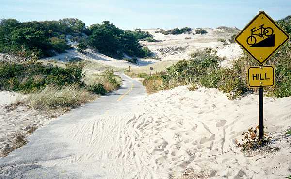
| Soon after the exit from the parking lot, the user encounters the first steep downgrade and sand (location D on map). |
Steep downgrade and sand on trail -- D on map
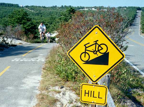
Another steep downgrade - E on map. The parallel road is level and lightly traveled.
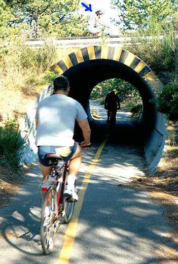
The path crosses the road at two underpasses. These are small-section corrugated galvanized steel culverts, with little enough headroom at the sides that bicyclists keep to the middle. In the photo below, notice that there is also a bicyclist (see blue arrow) riding past on the road overhead. Some bicyclists prefer the road, whether because it is faster and more direct, or safer, or whatever. [To this extent, I disagree with Bryce Nesbitt: there is significant bicycle traffic on the road. As of the summer of 2011, Share the Road signs have been installed on most of these roads.] |
Underpass (location F on map, looking east)
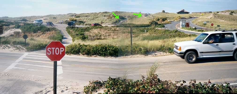
| The Race Point Beach spur of the path crosses the roadway that leads to the Provincetown airport, and then a parking lot (photo below, location G on map). Note the extremely steep section of trail in the background (green arrows). [The steep section has been closed as of summer 2011 -- bicyclists ride in the parking lot and on the road. instead.] |
Race Point spur. The picture is bowed in the middle because
I had to stitch two photos together to get enough
coverage with my little camera. G on map.
| Scroll right if necessary to see the rest of the image.
Scroll left if necessary to view text, and rest of image. |
| At the parking lot, bicyclists are expected to traverse a storm-drain cover which has sunk below the pavement, then turn sharply into the curb cut on the traffic island at the right of the photo below. Most bicyclists, like the one in the photo, ride around the end of the island instead. The extremely steep segment of the trail is visible at the rear of this photo. [As of summer 2011, the entrance to the parking lot has been improved, and the steep section closed, as already described.] |
Trail crosses parking lot for Race Point Beach
and then goes up the very steep side of a sand dune.
The beach is just past the sand dune.
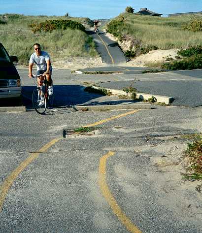
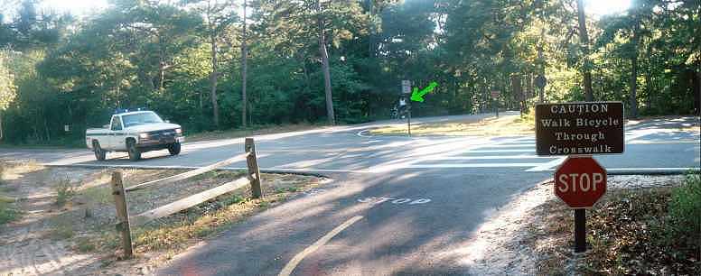
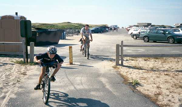
| Back along Race Point Road toward Provincetown is another point of entry for the trail system, at a parking lot in pine woodlands. The trail does not continue into Provincetown, and neither is the road widened for bicycle/motor-vehicle lane sharing. Traffic on Race Point Road is heavier than on other roads that parallel or lead to the trails: Race Point Road is the main route to the Provincetown Airport and Race Point Beach. [As of the summer of 2011, Share-the-Road signs have been installed on this road, as well as others in the National Seashore.] |
Trail crossing Race Point Road at entrance to the
National Seashore Park. Bicyclists coming from
town ride the relatively narrow road (left). Note tracks in sand and
bicyclist in parking lot driveway (green arrow).
Parking lot is past trees on right. H on map.
Scroll right if necessary to see the rest of the image.
Scroll left if necessary to see the rest of the image. |
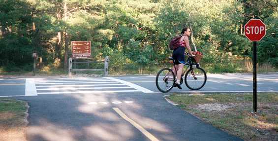
The same crosswalk seen from the other end.
In this area, farther from the oceanfront,
the path passes through pine woodlands..
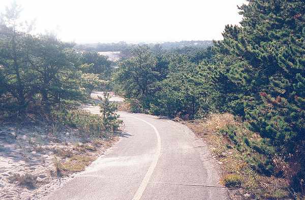
| The trail that leads west from the parking lot passes through woodlands and then transitions back to the sand dunes. |
Trail west from the parking lot (I on map).
Recommendations
|