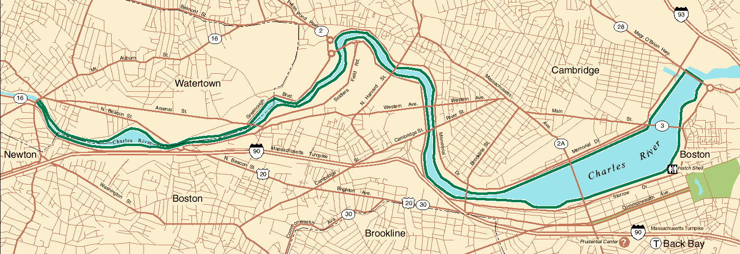
MAP OF PAUL DUDLEY WHITE
BICYCLE PATHS
This map is in the public domain, downloaded from a Metropolitan District
Commission Web site. The paths extend from Watertown Square, at the west end, to the
Charles River Dam bridge at the east end.
Paths as far west as Fresh Pond Parkway on the north side of the river,
and the Boston University Bridge on the south side, were built, or redesignated, in the
1960s.. The remainder of the paths was built in the early 1980s.
To read the Web pages about various segments of the paths, go back to the Table of Contents. Path segments are listed under the different
cities and towns in the Table of Contents and marked with an X
in the column with the Paul Dudley White Bicycle Paths heading.
The Metropolitan District Commission has additional maps and descriptions of the
Charles River Lower Basin online. |