Top: Home Page
Up: Table of Contents
Previous:
Next:
John S. Allen, May 20-22, 2004
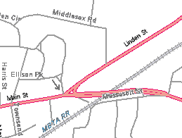
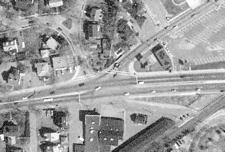
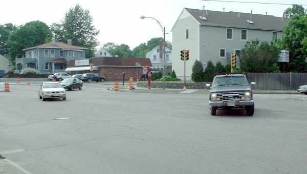
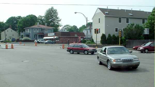
As of May 2004, the Main street/Linden Street/Ellison Park intersection in Waltham, Massachusetts is under reconstruction. Elements of the reconstruction include pedestrian crosswalks, new traffic signals, and a new traffic island. The changes to the intersection appear primarily to be intended to improve conditions for pedestrians. The photos below were taken on May 18 and 22, 2004, when construction of traffic islands and wheelchair ramps was nearly complete, but the new traffic signals had not yet been installed. This is a five-way intersection, as shown in the map and aerial photo below. All of the streets are two-way except Ellison Park, which is one-way toward the intersection, as indicated by the arrow. Traffic is heavy on Linden Street and Main Street, moderate on Ellison Park, and very light on the stub of a street just south of Main street which ends at the railroad tracks. |
| The photo below looks eastward across Linden Street and along the north side of Main Street. |
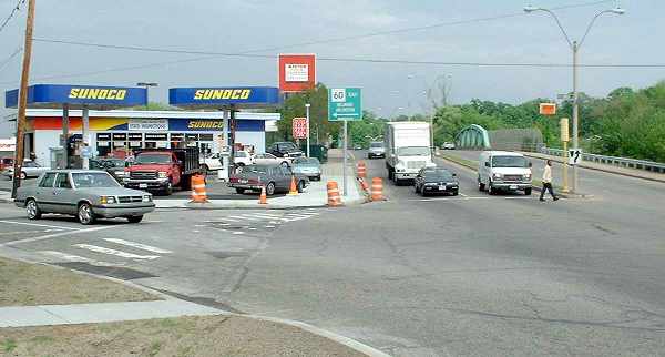
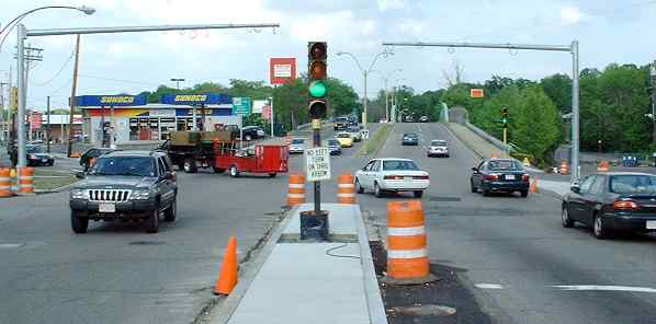
| New wheelchair ramps are visible, along with the old crosswalk across Linden Street and the absence of crosswalk markings where the pedestrian is crossing Main Street. Now, let's look at traffic flow in the intersection. Traffic signals currently have three phases for vehicles entering from different directions: |
|
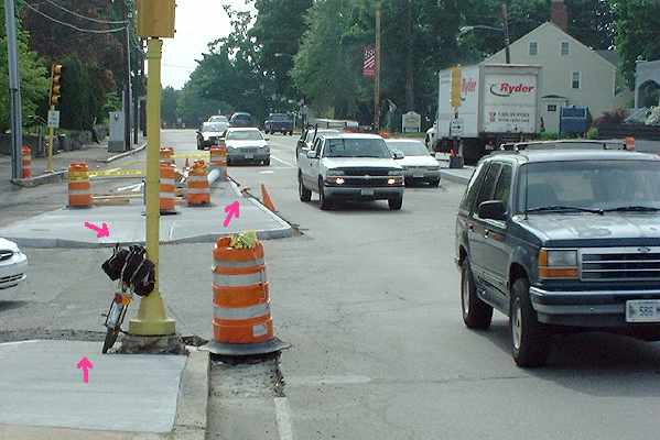
In addition, there is presently an additional pushbutton-actuated pedestrian signal phase. I do not know what the signal phasing will be with the new signals; it might be better than the present phasing. However, the alignment of the new island is my major concern with the intersection design. |
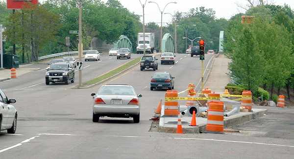
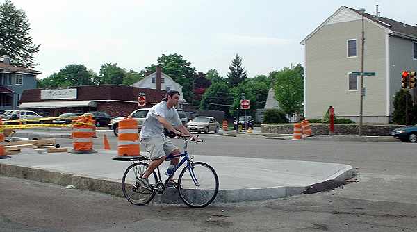
As the photo shows, it seriously narrows the right-hand travel lane. This narrowing could potentially result in motorists' colliding with the curb or with each other, and also poses a problem for bicyclists. The bicyclist in the photo below has chosen to go around the right side of the island in order to avoid the narrowing channel to its left. It is hard to believe that this installation complies with the Massachusetts Highway Department's bicycle accommodation guidelines. |
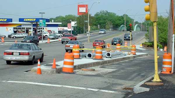
Next, we look toward the island from the railroad bridge. The red arrows in the photo below show the locations of wheelchair ramps. |
| The ramp on the Main Street side is halfway back along the island, and the continuing
intrusion of the island toward the foreground in the photo does nothing to decrease
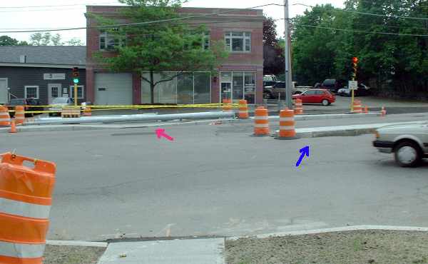
pedestrian crossing distance. The same ramp is indicated by the red arrow in the photo below, the viewpoint of which is from the north side of the intersection between Ellison Park (to the right) and Linden Street (to the left). A new pedestrian crossing of Main Street makes no use of the median island in Main Street (blue arrow) as a pedestrian refuge. |
| There is also no convenient ramp to the island for pedestrians headed east on Main Street, as shown in the photo below. |
| Large trucks serve a business on the dead-end street south of the railroad bridge. With the new island, they can not negotiate the left turn from Main Street, as shown in the photos below. The channel at the end of the island is too narrow to allow them to avoid a utility pole. |
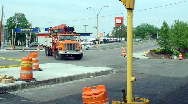
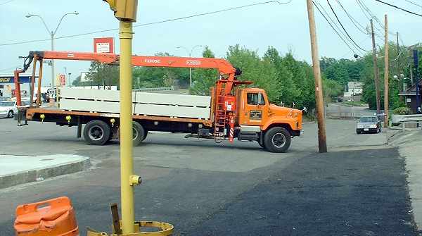
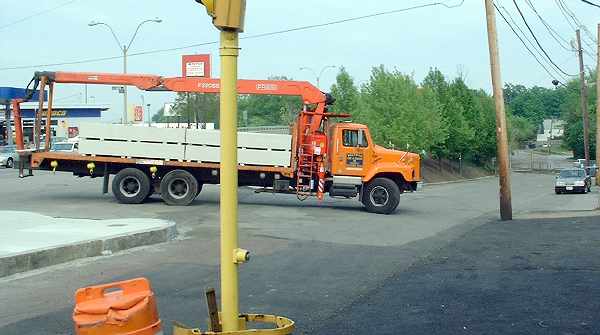
| Note also that there is no sidewalk here, although there is a pedestrian pushbutton on
the (old) signal pole in the foreground. Pedestrians must cross the a parking area in the
lower right of the photos and then walk in an awkward location in the street to get the
the pedestrian ramp at the far end of the island which is visible in the photos. What might have improved this intersection, and might still be done? First, the easy possibilities:
And now the more difficult possibilities, given that construction is nearly complete:
|