Top: Home Page
Up: Cambridge bicycle facilities and program
Previous:
Next:
PAUL DUDLEY WHITE BICYCLE PATH,
|
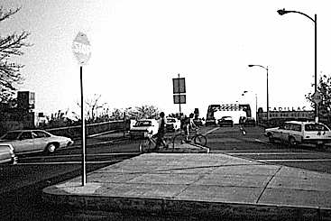
Cambridge end, Boston University Bridge, 1978
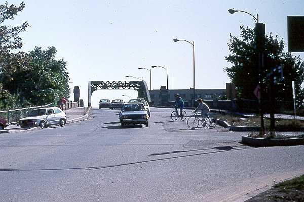
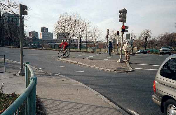
In 1982, a major reconstruction of the intersection was undertaken. The traffic islands were redesigned. The crosswalk channel through the more distant island was now closer to the intersection. Traffic signals had been installed, interrupting the flow of traffic across the crosswalk. At the time the photo was taken shortly after reconstruction, crosswalk lines and other pavement markings had been temporarily lost during repaving. In both the 1978 and 1982 photos, bicyclists are going around the islands rather than through the channels in the islands. The channels, designed to pedestrian standards, are too narrow to accommodate one bicyclist overtaking another, or two traveling head-on. The same comments apply to wheelchair users. |
Cambridge end, Boston University Bridge, 1982
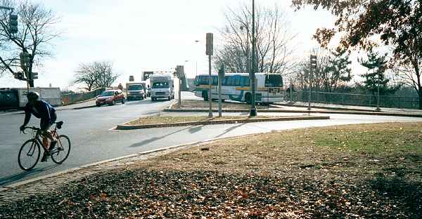
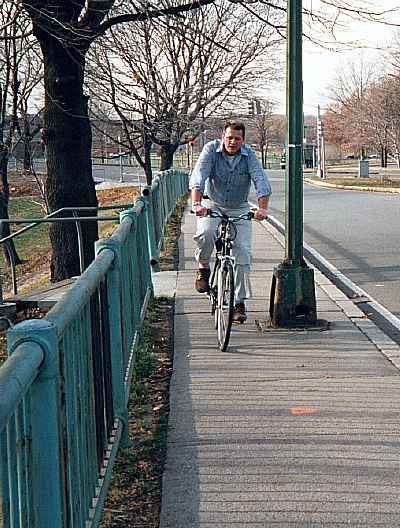
| The photo below was taken in 2001; the intersection remains essentially as in 1982. At
the right side of the photo, where the bus is turning on the ramp up to the bridge, there
is only one wide lane to the right of the island. The bridge now feels much less cramped
for a bicyclist heading toward Boston on the roadway, because there is always only one
lane of traffic entering the bridge to the left of bicyclists, but the bridge has two
lanes in each direction. The bicyclist in the photo entered Memorial Drive somewhere to the right of the photo, and has correctly merged in vehicular style to the inside of the rotary which connects the BU Bridge to the streets of Cambridgeport. The vehicular style is much quicker here than making one's way through three different crosswalks. |
Cambridge end, Boston University Bridge, 2001
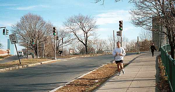
The photo below looks across the intersection from west to east (right to left in the photos above). Note the single lane of the ramp leading up onto the bridge, and the signalized crosswalk, whose striping is, however, badly worn. |
Looking across Cambridge end of BU Bridge
west to east, 2001.
The photo below looks across the intersection in the opposite direction, from east to west. The cyclist is riding around the island, because following the crosswalk cuts would require him to turn to the left, then to the right, and then very sharply to the left to continue toward the camera. The break in the railing at the left side of the photo is for access to parkland along the river, and dates from approximately 1999. A signal post is poorly placed, where it gets in the way of bicyclists turning left toward the camera from the crosswalk. |
Looking across Cambridge end of BU Bridge
east to west, 2001.
Just east of the Boston University bridge is a narrow section of the two-way path, an old sidewalk that has not been upgraded in any way. The highway ramp next to the path is unnecessarily wide. The path could be widened by narrowing the ramp. In the 1978 photo below, the pavement is deteriorating. |
Sidewalk path east of BU Bridge, 1978
| During the 1982 reconstruction, the path was repaved, but not significantly widened. As part of the same project for access to riverfront parkland already described, stairs were constructed down from the path. These stairs allow pedestrians to enter the path where its usable width is narrowed by the lamppost. The pavement is in good shape now, but the lamppost's base is deteriorating. The open access door and a rust hole expose electrical wiring inside. |
Sidewalk path, 2001
| The same lamppost and stairs are visible in the background of the photo below. In the foreground is the railroad underpass also visible in the background of a photo on another page. Note that the bridge abutment is wide enough that the path might also be widened here by extending it toward the left in the photo. There is a step, high enough to damage a bicycle's rims, between concrete slabs at the east end of the bridge (bottom of photo). |
Railroad underpass, 2001
Top: Home Page
Up: Cambridge bicycle facilities and program
Previous:
Next: