Top: Home Page
Up: Alewife Station area
Previous: Aerial photo
Next: Panorama north of station
FITCHBURG CUTOFF PATH,
|
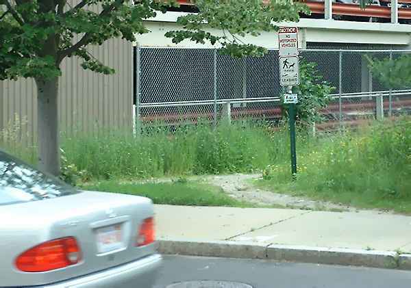
Entrance to Fitchburg Cutoff path, June, 2002.
The sign is new.
Vegetation has encroached on the Fitchburg Cutoff path, and its surface has deteriorated over the years. Much of the damage is from off-road motorcyclists who use the path to access wetlands just to its north. The motorcyclists are prohibited from both the path and the wetlands, as indicated by the sign in the photo below. The wording of the sign is somewhat incorrect, as the path is in fact designated for bicycle and pedestrian use. If the path were improved, fewer motorcyclists would be likely to use it, as there would be more legitimate users to monitor and report abuse. |
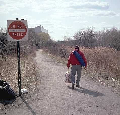
Looking west along the path,
just west of Alewife Station, 2001.
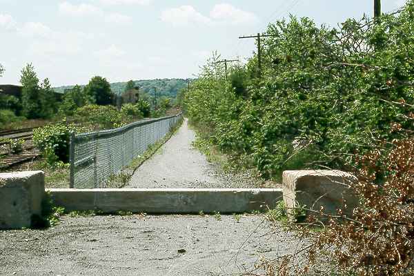
| Near the Belmont end of the path, it becomes very narrow as it rejoins the main rail corridor; it is separated from the tracks by a fence. A concrete barrier is supposed to prevent motor vehicle access; the barrier makes for a slightly inconvenient detour for bicyclists and the illegal motorcyclists, and it could lead to a serious crash if someone fails to notice it. The first of the photo below was taken in 1990. Note the "donut" tire tracks in front of the barrier made by a motorcyclist. |
Barrier near Belmont end of path, looking west, 1990.
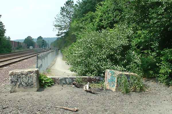
| The final photo was taken in 2002 at the same location. The vegetation has grown, narrowing the trail. Also, the concrete block at the right side of the barrier has been moved to make it easier to ride around the barrier. That's no mean feat -- the block weighs hundreds of pounds. Maybe the Metropolitan District Commission moved it or maybe a disgruntled user did. Somebody knows, but I don't! |
Barrier near Belmont end of path, looking west, 2002.
| Top: Home Page Up: Alewife Station area Previous: Aerial photo Next: Panorama north of station |
Contents © 2002, 2005, John S. Allen , |