Top: Home Page
Up: Table of Contents
Previous: Introduction
Next: Fitchburg Cutoff path


AERIAL VIEW OF ALEWIFE STATION AREA


Locations are indicated on the photo.
You may also view a smaller version, with
captions nearer the locations they describe.

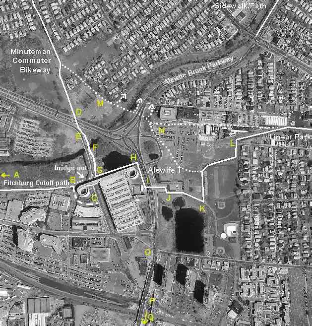
Fitchburg Cutoff Path -- locations A through C at the left side of the aerial photo. Minuteman Bikeway to Linear Park -- locations D through L: follow the white line that starts at the upper left of the photo.Overview of trail locations with links to descriptions East of station, locations H through K), and potential direct Minuteman-Linear Park link, M, N, L.


Alewife Brook Parkway and railroad overpass:
locations O, P, Q at bottom of photo.

alemapsm.jpg (22655 bytes)


Top: Home Page
Up: Table of Contents
Previous:Introduction
Next: Fitchburg Cutoff path

Contents © 2002, John S. Allen ,
except aerial photo, Mass GIS
with additions by Bryce Nesbitt and John S. Allen.
May be reproduced, with attribution.