Top: Home Page
Up: Alewife Station area
Previous: Crosswalks
Next: Alewife Brook Parkway
CONNECTION TO LINEAR PARK
|
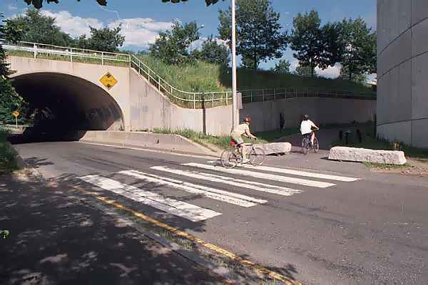
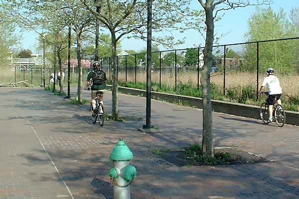
Crossing from sidewalk to path on east side of Alewife Station
Crossing viewed from other end
| The trail shown in the foreground of the photo above continues past the playground of
a day-care center behind the station, and ends at a blind corner of the underpass under
Alewife Brook Parkway (location I in aerial photo).
Day-care personnel indicate that they have witnessed collisions at this corner. The hazard here could be reduced by placing an open (see-through) barrier along the line between light and shadow that runs across the left foreground of the photo below, so that it would no longer be possible for trail users to turn sharply around the corner. |
View of blind corner with day care center playground and
parking
garage ramp structure in background.
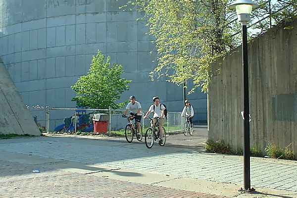
| Next, the bicycle route passes through a plaza next to the headhouse of the Red Line subway terminal (location J in aerial photo). It is hard for people who do not know the area to figure out how to get to the Linear Park (right side of aerial photo) or other destinations; also, the lack of a delineated right-of-way through the row of trees leads to potential confusion and collisions. The photo below looks back toward the station past the headhouse. |
Headhouse plaza, looking west toward Alewife Station
| The photo below looks in the opposite direction along the pedestrian plaza. In the background, you can see the grandstands of an athletic field. |
Headhouse plaza, looking east away from Alewife Station
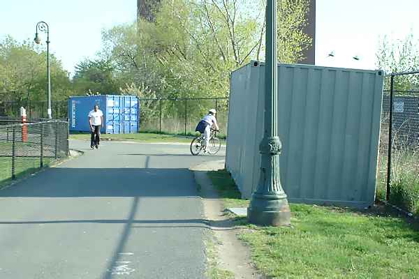
| The photo below looks down the path from north to south, with the athletic field on the left. The path has a three-way intersection here, location K in the aerial photo. Parked adjacent to the intersection is a shipping container, probably used to store athletic equipment. The thoughtless placement of this container (in the right foreground in the photo below) blocks the view around the corner and constitutes an unnecessary hazard. |
| The route between the Minuteman Bikeway and the Linear Park is very circuitous. A
shorter route might more or less follow one of the the dotted lines at the top of the aerial photo, more or less along the route of a rail line
that formerly connected the rail corridors that have become the Linear Park and the
Minuteman Bikeway. It is my opinion that an overpass would be warranted at the Parkway,
because a signalized crosswalk would be less safe and would add to the already serious
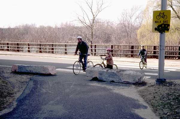
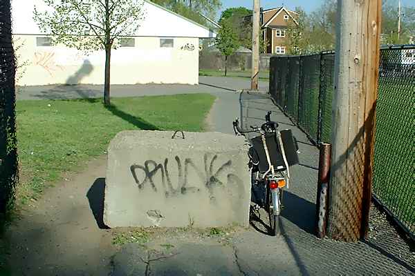
traffic jams in the area. While the creation of a this route would be expensive, it would make travel on foot or by bicycle between North Cambridge and South Arlington much more practical. The present "pillar to post" route is neither safe nor convenient. An overpass or crosswalk on Alewife Brook Parkway east of Route 2 would also provide access to the parkland on the north side of the Parkway for Cambridge residents. Rindge Avenue in Cambridge may be reached by continuing on the path to the left of the blue storage container in the background of photo above. This route is more direct, but there are still problems. The large block shown below is on the most direct route. A much less obstructive and less hazardous barrier would be sufficient to keep motor vehicles off the path. |
| Top: Home Page Up: Alewife Station area Previous: Crosswalks Next: Alewife Brook Parkway |
Contents © 2002, John S. Allen , |